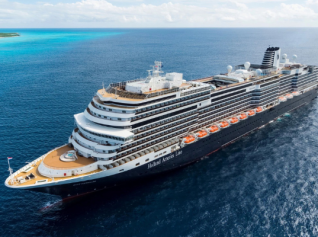
‘Erroneous’ nautical mapping blamed for cruise ship accident
Incorrect mapping information has been blamed by Louis Hellenic Cruises for the sinking of the cruise ship Sea Diamond off Santorini in April.
The results of a detailed hydrographic survey of the area of the accident have revealed that the reef, which the ship struck, was lying at a distance of 131 meters from shore and not at a distance of 57 meters as it is incorrectly marked on the nautical chart, the company said.
“The aforementioned findings demonstrate that based on the said nautical chart, the vessel was on a safe course during the approaching to her assigned mooring position in Santorini,” a statement said.
“It is evident from the above findings that the cause of the accident was the erroneous mapping information contained in the nautical chart.”
by Phil Davies


Phil Davies


Vegas’s Billion-Dollar Secrets – What They Don’t Want Tourists to Know

Visit Florida’s New CEO Bryan Griffin Shares His Vision for State Tourism with Graham

Chicago’s Tourism Renaissance: Graham Interviews Kristin Reynolds of Choose Chicago

Graham Talks with Cassandra McCauley of MMGY NextFactor About the Latest Industry Research

Destination International’s Andreas Weissenborn: Research, Advocacy, and Destination Impact

Graham and Don Welsh Discuss the Success of Destinations International’s Annual Conference

Graham and CEO Andre Kiwitz on Ventura Travel’s UK Move and Recruitment for the Role

Brett Laiken and Graham Discuss Florida’s Tourism Momentum and Global Appeal

Graham and Elliot Ferguson on Positioning DC as a Cultural and Inclusive Global Destination

Graham Talks to Fraser Last About His England-to-Ireland Trek for Mental Health Awareness

Kathy Nelson Tells Graham About the Honour of Hosting the World Cup and Kansas City’s Future

Graham McKenzie on Sir Richie Richardson’s Dual Passion for Golf and His Homeland, Antigua


Higher departure tax and visa cost, e-arrival card: Japan unleashes the fiscal weapon against tourists
Euromonitor International unveils world’s top 100 city destinations for 2025
U.S.A. and Israel attacks on Iran impact air movements in the Gulf (Update 1.00pm CET)
Global tourism exceeds 1.5 billion travelers announces UN-Tourism
WTTC global tourism reached record economic impact of 11 trillion in 2025