Impressive snow levels promise excellent skiing
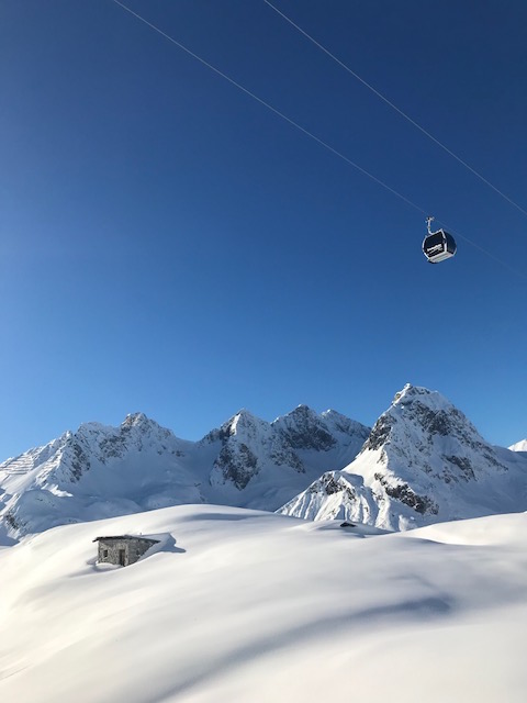
The weather has caused fresh havoc in parts of the Alps again this week but, generally speaking, snow cover remains very impressive and there will be some excellent skiing once things calm down.
The bulk of the new snow has fallen in the northern half of the Alps, including in resorts such as Val d"Isere, Courchevel, Flaine, Chamonix, Avoriaz in France, Verbier, Engelberg and Klosters in Switzerland, a good part of Austria including St Anton and Kaprun, and in some north-western parts of Italy, such as Courmayeur.
By the end of the weekend some of these areas will have seen seven-day storm totals close to two metres, at least at altitude. There has also been some rain lower down, although nothing too serious yet, but it may become more of an issue later on Sunday and Monday.
The bigger problem so far has been the wind, seriously disrupting lift operations (especially at altitude) in the western Alps (eg Zermatt, Val d’Isere), and leaving the off-piste situation particularly precarious.
Here’s a country by country rundown, courtesy of the Ski Club.
Austria
Snow cover is impressive across most of the Austrian Alps, especially at altitude in the west where St Anton now has 80/300cm and Obergurgl has 105/275cm.
Most of the recent snow has been in the north and west of the country, but that’s not to say that you can’t still find some excellent skiing further south.Nassfeld, for example, has been offering some fabulous piste skiing in recent days, not least because the weather has been more clement.
The forecast is very mixed over the next few days with further snow for many but also some rain lower down, especially later in the weekend and on Monday.
France
It has been another very wild week in the French Alps with further heavy snow contributing to some truly massive base depths now at altitude in the north. Flaine now has 140/380cm depending on altitude, while Val Thorens has 225/240cm and Les Arcs has 120/330cm.
Lower down, the relatively mild temperatures (and some rain) means that snow depths are a bit more ‘normal’ in the likes of Les Gets but, above about 1300m, the snow pack is much deeper than average just above everywhere.
Watch out for some further bad weather over the weekend with a rising rain/snow level later on Sunday and Monday.
Italy
Snow conditions are generally excellent across the Italian Alps though the weather conditions have been challenging at times this week, especially in the north-west. This is also where you will find the deepest snow, with base depths of 190/300cm in Cervinia and 110/240cm in Courmayeur.
However, while the weather remains unsettled, some of the best skiing can actually be found further east in the Dolomites. Here Cortina has 50/120cm of settled snow depending on altitude, while Alta Badia has 70/180cm.
Switzerland
With the exception of some lower parts of the far northern Swiss Alps, snow cover remains impressive across most of Switzerland, even exceptional in the south-west where base depths are now 150/300cm in Zermatt and 80/270cm in Verbier.
Further north, there is a bigger gulf between top and bottom depths, as seen in both Wengen and Engelberg, whose glacier has the deepest pisted base in the Alps.
Expect further snow in most regions over the next few days but with a rising rain/snow limit later in the weekend and into the first part of next week.
Rest of Europe
The Pyrenees have not seen a huge amount of snow recently but conditions remain pretty good, especially on-piste. Andorra’s Arcalis has base depths of 75/140cm while Spain’s Baqueira Beret has 124/180cm.
Scottish ski resorts have seen plenty of snow recently with some excellent conditions in prospect once the weather calms down. Glencoe has seen around 50cm of fresh with upper base depths now approaching 80cm.
Most Norwegian resorts have also seen fresh snow. Hemsedal, for example, has had 20cm and now has an upper base 120cm deep.
USA
Snow depths are still considerably below par across most of Colorado and Utah. While the piste skiing may still be good here, it does mean that the off-piste is often still quite limited. Vail currently has upper depths of 79cm while Park City has 64cm. Snow is forecast for both states this weekend but only in moderate quantities.
Further north, Jackson Hole has more impressive snow depths, still thanks to the big storms much earlier in the season.
Canada
It’s snowing again in Whistler and will continue to do so over the next days, with some really significant accumulations at altitude. At resort level a little rain could be mixed in at times, but overall the picture is a very positive one.
Further inland, any snowfall will be much lighter, but colder temperatures in the Banff area mean that skiing conditions here are also good, especially on piste.


Linsey McNeill
Editor Linsey McNeill has been writing about travel for more than three decades. Bylines include The Times, Telegraph, Observer, Guardian and Which? plus the South China Morning Post. She also shares insider tips on thetraveljournalist.co.uk


Vegas’s Billion-Dollar Secrets – What They Don’t Want Tourists to Know

Visit Florida’s New CEO Bryan Griffin Shares His Vision for State Tourism with Graham

Chicago’s Tourism Renaissance: Graham Interviews Kristin Reynolds of Choose Chicago

Graham Talks with Cassandra McCauley of MMGY NextFactor About the Latest Industry Research

Destination International’s Andreas Weissenborn: Research, Advocacy, and Destination Impact

Graham and Don Welsh Discuss the Success of Destinations International’s Annual Conference

Graham and CEO Andre Kiwitz on Ventura Travel’s UK Move and Recruitment for the Role

Brett Laiken and Graham Discuss Florida’s Tourism Momentum and Global Appeal

Graham and Elliot Ferguson on Positioning DC as a Cultural and Inclusive Global Destination

Graham Talks to Fraser Last About His England-to-Ireland Trek for Mental Health Awareness

Kathy Nelson Tells Graham About the Honour of Hosting the World Cup and Kansas City’s Future

Graham McKenzie on Sir Richie Richardson’s Dual Passion for Golf and His Homeland, Antigua


Higher departure tax and visa cost, e-arrival card: Japan unleashes the fiscal weapon against tourists
Singapore to forbid entry to undesirable travelers with new no-boarding directive
Euromonitor International unveils world’s top 100 city destinations for 2025
U.S.A. and Israel attacks on Iran impact air movements in the Gulf (Update 1.00pm CET)
Global tourism exceeds 1.5 billion travelers announces UN-Tourism