See which resorts offer the best skiing this week
As Easter approaches, the Ski Club’s latest snow report unveils the best spots for winter activities.
OVERVIEW
There have been mixed skiing conditions across Europe this week, with new snow continuing to arrive in the East over Austria and the Dolomites on Monday, while further west the sun has become increasingly prevalent. By Thursday, almost the full range of skiing areas were seeing bright sunny days. Despite the sun, the temperatures continued to be somewhat lower than you may expect, than has been seen earlier this month, going some way to preserving preferable riding conditions. Though the coming weekend is not forecast to bring substantial new snow, this is likely to change in the early part of next week where what currently looks to be substantial snowfall is on the way for the North West Alps.
Andorra has continued to see very promising late season conditions, with two days of movement between heavy snow and bright skies. Wind did limit lift operations on Wednesday, however this passed by Thursday when normal operations had resumed.
Across the pond, Western Canada is expecting a substantial late March snowfall across both Alberta and British Columbia, with many resorts in like for 20-30cm over the coming day into the weekend. Once more, it looks as if Whistler will see the largest accumulations. The good news continues in California, with another 50cm+ day forecast for Thursday thanks to dropping temperatures. The resorts across Utah and Colorado are doing far less well however, with rain on the horizon risking harm to their recent fresh snow from the previous weekend.
SNOW ALERT
Based on current weather forecasts for the next 9 days, the top three resorts for expected snowfall are:
Zermatt, Switzerland, 130cm
Solden, Austria, 126cm
Argentiere, France, 117cm
AUSTRIA
Light to moderate snowfall came down over a number of Austrian resorts and regions this week delivering between 5-20cm of fresh snow across the majority of our Austrian resorts. Thursday, however, saw a change in conditions, with the arrival of bright sunny skies across the country resulting from a high pressure
Slope conditions were aided by continuing low temperatures delivered by air currents above the Alps. This is helping to preserve the quality of the snow that has fallen, keeping it fresh and preventing freeze thaw conditions that we saw earlier in March. There is however the potential for the bright sun to soften up the snow on south facing slopes over the course of increasingly long days. Expect favourable slope conditions across the mountains, with the continual snowfall over the past days preventing the off piste from becoming too heavily tracked except in the busiest of slopes.
The weather beyond heading into the weekend looks unsettled, with slightly warming conditions most prominently on Sunday and Monday. The sunny skies are most likely to continue over this period, running until the early part of next week at which point the last substantial snowfall for March looks likely to arrive
FRANCE
It looks like spring conditions have kicked in. Sunny weather has been prevalent, and with the exceptionally good snow conditions this year, if you are thinking of going skiing before the season finishes you certainly won’t be disappointed. One exception to this can be seen in Val Thorens (275cm/360cm) where it is sunny but bitterly cold, with lows of -16C. 10cm of fresh snow fell on Wednesday, and there are some good options for fresh tracks around the upper slopes of the 3 Vallees. There has been the odd scattered snow shower in the past few days, however, not the same quantities that were seen last week. Cauterets (110cm/310cm) recorded the largest amount of snow, with 25cm on Wednesday. The sun is set to continue through today (Friday), with snow expected in the French Pyrenees on Saturday and Sunday.
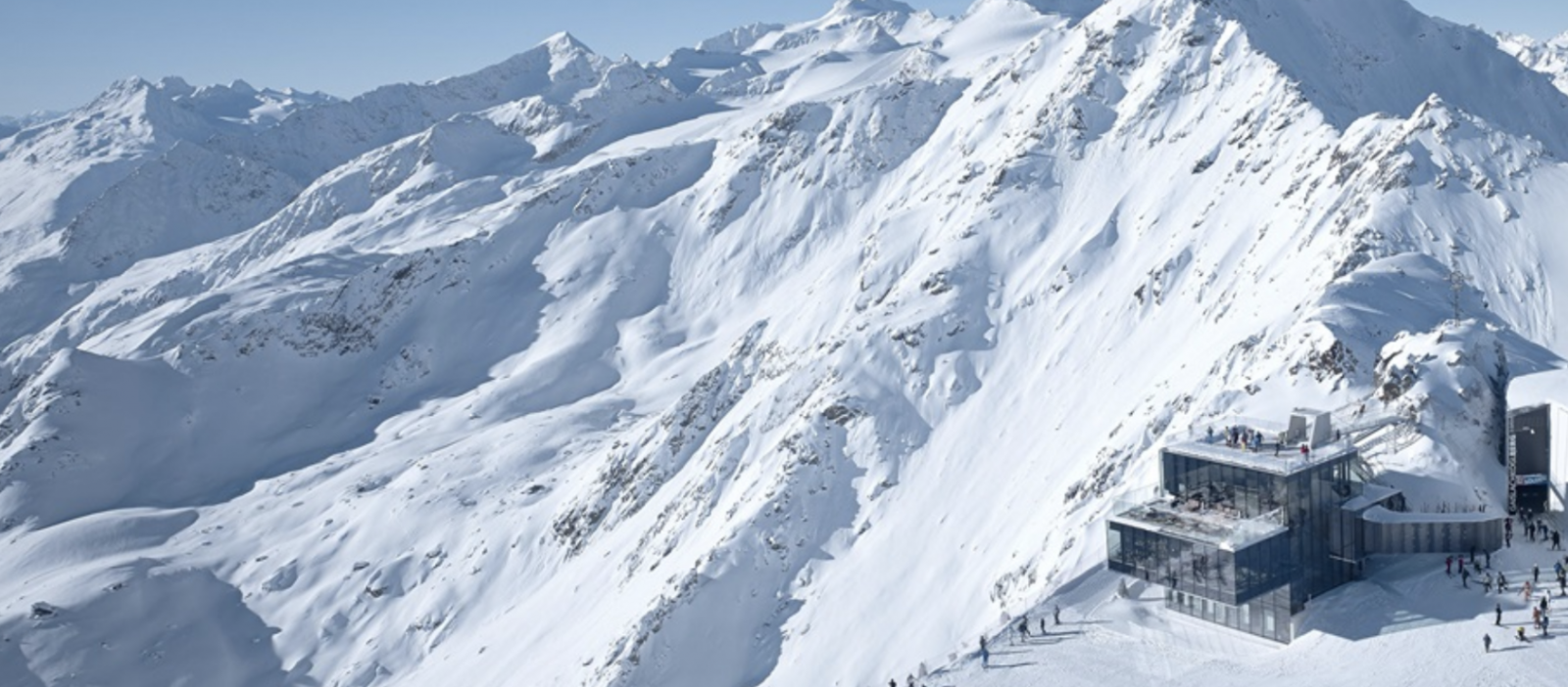
SWITZERLAND
Thursday brought fairly changeable weather across Switzerland. For resorts near the Matterhorn such as Zermatt (155/385cm), Saas Fee (120/460cm) or Grimentz/Zinal (125/306cm) light clouds dotted the sky, and with temperatures well below freezing it made for a lovely (but cold) ski day. Likewise, at Les Diablerets (40/270cm) there were stunning views from the top of Glacier 3000, and with 25/26 lifts spinning coupled with a dusting of fresh snow, the riding conditions up high were excellent.
The 4 Vallees too have enjoyed great weather, it was around -12C Wednesday at Verbier (95/365cm) and Thursday morning saw the continuation of the bright skies. The resort had 88/94 pistes open and well groomed, meaning options across the mountain were plentiful for skiers of different abilities.
In contrast the Jungfrau region was largely in cloud on Thursday morning, and forecasts were suggesting that there could be around 5-7cm of new snow for Murren (128/447cm), Grindelwald (10/181cm) and Wengen (29/181cm). There was roughly 10cm of fresh snow at the latter Wednesday, and whilst visibility was not great for the previous 48 hours, it did provide the opportunity to ski some powder on piste; something to be savoured as we head towards Easter.
Cloud and snow is expected to envelop much of the Swiss Alps for the weekend and beyond. Quantities of snow forecast to fall are not huge, but certainly enough to provide great fresh piste skiing. Tuesday looks like the next day to keep a real eye on, around 30cm of snow is expected to fall, and accumulations may be most heavy in the west close to the French/Swiss border. The snow is forecast to continue to fall heavily into Wednesday, and by Easter weekend there is every chance that conditions could be absolutely brilliant for those getting out for the holidays.
ITALY
Tuesday this week saw the end of the cloud and snow over Italy, instead giving way to beautiful bright days and slightly warmer temperatures than the much of the rest of the Alps. Though it’s not quite t-shirt weather yet, it is definitely time to start thinking about sun cream if you’re skiing in Italy, with near identical conditions across the skiing regions of the country.
The pistes appear to be remaining good and firm despite the sun thanks to the low temperatures still holding back any serious spring conditions. It is slightly warmer in the west than the east, though remaining below freezing across the board. Off piste conditions are increasingly tracked in the more accessible slopes, though pockets of fresh snow will be available, especially in resorts that saw more substantial snowfalls early in the week. The weekend has the potential to bring light cloud cover, somewhat diminishing the great conditions though not to a significant degree. The forecasts are still currently predicting a more substantial snowfall in the early period of next week, in line with much of the rest of the Alps.
ANDORRA
Wind affected lift operations across much of Andorra on Wednesday, though this had passed by Thursday, with another day of glorious sunshine. On the plus side, the Grandvalira area in particular saw another substantial late season snowfall, totalling more than 50cm over the last two days, leaving plenty of fresh powder to be skied on Thursday and Friday. There’s little signs of these great late season conditions abating, with more snow over the weekend on the way.
SCANDINAVIA
Wednesday saw the welcome arrival of a small amount of fresh snow over Ruka (88cn),~albeit only a light dusting of 5cm over a hard base. Unfortunately neither of our other featured resorts in Finland saw snow, raising the possibility they may now not before the end of the season. More new snow has kept the slopes at Are (121cm) in great shape, providing the best option for skiing in Sweden currently. Light clouds and mild weather help to provide lovely spring conditions with the majority of lifts running on two of the three slopes. Salen (132cm), though without new snow is not suffering to a great degree, with equally pleasant weather and a greater number of trails and slopes still on offer.
In Norway, there has been a limited amount of new snow, with some of the slopes that constitute the Lillehammer (60/223cm) ski area seeing light dustings. The headline news however is the arrival of some welcome late season snow in Oppdal (50/90cm), which saw 33cm over the past 3 days ending an extended dry spell. Voss (90/270cm) reported a total of 36cm over the same period, resulting in the conditions there likely being the best on offer in Norway. The hard pistes in Geilo (120cm) are best avoided given the better options available. The current mild spell looks set to continue for a few days before an abrupt end early next week when temperatures will drop once again to double digits below freezing.
GERMANY
Spring skiing in fully underway, with sunny weather and slopes depths slowly decreasing. There was one exception; Oberstdorf (10cm/220cm) received fresh snow this week, with 10cm during the early hours of Thursday. There are some very light snowfalls expected over the weekend, but nothing that would dramatically improve slope quality.
EASTERN EUROPE
Spring conditions have started to show in our featured Eastern European resorts. However, there is some good news for resorts in Bulgaria, as all three are expecting good amounts of fresh snow. Bansko (80cm/210cm) is forecast as much as 42cm by Sunday evening, which in turn is great timing as the slopes were looking worse for wear. Pamporovo (90cm/120cm) has also forecast a healthy 32cm of fresh snowfall by Sunday evening. Elsewhere in Eastern Europe slope depths are decreasing, with Sochi – Rosa Khutor(35cm/395cm) seeing the most severe drop of around 9cm from its upper slopes since Monday. The possibility of rain throughout the day this could well see this get worse.
SCOTLAND
Temperatures rose to as high as +4C in Glenshee (100/125cm) in Scotland on Thursday, and with Easter around the corner the snow is largely spring like and forgiving across the countries five ski centres. Lower slopes are starting to show signs of wear now, and the last 20 metres of the red run down the car park at Glencoe (175/195cm) was broken and patchy. However, snow on the upper slopes is holding well against the thaw, and indeed at Nevis Range (50/130cm) there was a significant ice hazard at the top station.
Snow is set to return today (Friday), but accumulations over the weekend are not predicted to be spectacular. Early next week shows signs of promise for larger dumps, with resorts in the west predicting around 20cm on Tuesday.
USA
The weather and corresponding conditions are once again a mixed bag across the USA, with warm weather bringing rain this time to the central Rockies. Temperatures in Utah and Colorado are above freezing almost across the board, with lighter rain in Colorado growing heavier in Utah. If the forecast rain does materialise, it risks harming the fresh snow from the weekend just gone, so fingers crossed it passes over. These mild conditions look to remain in place for a number of days, though once the temperatures drop there is the increasing risk of icy conditions developing on the slopes.
The north east offers more encouraging conditions, with lower temperatures thanks to the fourth winter storm of the month in the region. Expect overcast days but good snow conditions. Minimal new snow is predicted over the coming days however.
California is still offering conditions head and shoulders above the rest of the country, with the predictions indicating Thursday would be another huge day of snowfall as temperatures dropped once again.
CANADA
Snow was expected over resorts in Alberta and British Columbia on Thursday, with little sign of spring arriving even at the tail end of March other than in terms of temperature, which continue to move upwards towards freezing point. Whistler (288cm) is currently on course to receive the lion’s share of the new snow, providing a substantial late season top up. While in Alberta, the snowfall is looking to grow heavier over the comings days, with Saturday in particular on course to be a great day riding powder.
It was somewhat colder, though without snow in the east, with no new snow expected over the coming days for either Mont Sainte Anne (50/136cm) or Tremblant (60cm).
JAPAN
The forecast snow did materialise over Hakuba (330/80cm) on Thursday, delivering a very welcome 5cm over Happo-one, while larger amounts were measured on the nearby slopes. This good news is somewhat negated by rain that followed on the lower slopes and high winds elsewhere, though hopefully this will at least improve conditions up high when the wind calms. Further north, Niseko (190/460cm) and Rusutsu (180/140cm) are both without snow, the latter skiing diminishing base measurements over the past week. Spring conditions have truly set in with a lesser likelihood of new snow, though at least Niseko is helped by substantial quantities still on the ground.


Bev
Editor in chief Bev Fearis has been a travel journalist for 25 years. She started her career at Travel Weekly, where she became deputy news editor, before joining Business Traveller as deputy editor and launching the magazine’s website. She has also written travel features, news and expert comment for the Guardian, Observer, Times, Telegraph, Boundless and other consumer titles and was named one of the top 50 UK travel journalists by the Press Gazette.


Vegas’s Billion-Dollar Secrets – What They Don’t Want Tourists to Know

Visit Florida’s New CEO Bryan Griffin Shares His Vision for State Tourism with Graham

Chicago’s Tourism Renaissance: Graham Interviews Kristin Reynolds of Choose Chicago

Graham Talks with Cassandra McCauley of MMGY NextFactor About the Latest Industry Research

Destination International’s Andreas Weissenborn: Research, Advocacy, and Destination Impact

Graham and Don Welsh Discuss the Success of Destinations International’s Annual Conference

Graham and CEO Andre Kiwitz on Ventura Travel’s UK Move and Recruitment for the Role

Brett Laiken and Graham Discuss Florida’s Tourism Momentum and Global Appeal

Graham and Elliot Ferguson on Positioning DC as a Cultural and Inclusive Global Destination

Graham Talks to Fraser Last About His England-to-Ireland Trek for Mental Health Awareness

Kathy Nelson Tells Graham About the Honour of Hosting the World Cup and Kansas City’s Future

Graham McKenzie on Sir Richie Richardson’s Dual Passion for Golf and His Homeland, Antigua


Phocuswright reveals the world's largest travel markets in volume in 2025
Higher departure tax and visa cost, e-arrival card: Japan unleashes the fiscal weapon against tourists
Singapore to forbid entry to undesirable travelers with new no-boarding directive
Euromonitor International unveils world’s top 100 city destinations for 2025
Cyclone in Sri Lanka had limited effect on tourism in contrary to media reports