Strengthening Hurricane Irene starting to threaten travel
The first hurricane of the season in the Atlantic was strengthening Tuesday amid warnings it could have a major impact on some southern states. Already, the early-forming storm has had an impact on travel this week for both airline passengers and cruisers.
JetBlue, for example, says it will waive change/cancel fees and fare differences for consumers at least through today, on flights to and from Puerto Rico and the Dominican Republic. Others may follow.
Affected cities include San Juan, Ponce and Aguadilla in Puerto Rico;
Santo Domingo, Santiago, Puerto Plata and Punta Cana in the Dominican Republic.
Customers may rebook their flights for travel through Aug. 27 without paying change fees. Customers with canceled flights may also opt for a refund. Original travel must have been booked on or before Aug. 21, the airline says.
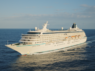
Carnival Cruise Lines said the Miracle has changed its itinerary to visit Grand Turk and Half Moon Cay instead of San Juan and St. Thomas.
Meanwhile, Royal Caribbean International said it has modified the itineraries of Oasis of the Seas, Allure of the Seas, Serenade of the Seas and Freedom of the Seas. The ships will call on the same port but in a different order.
Gov. Luis Fortuno of Puerto Rico declared a state of emergency Monday and urged people to stay indoors to avoid downed power lines, flooded streets and other hazards, according to the Associated Press.
Forecasters warned the storm could threaten Florida and South Carolina by the end of the week.
“Hurricane Irene moved through the northern part of Puerto Rico. It may become a category two or even three storm by the weekend when it could threaten Florida and the Southeast coast,” reports The Chicago Weather Center.
According to NOAA, this could be the first of as many as 19 named storms that may come. NOAA recently revised their forecast for the Atlantic hurricane season and is now predicting between 14 and 19 named storms (tropical storms or hurricanes).
At this time, current model track guidance is nearly unanimous in steering Irene towards the southeast coast by Friday or Saturday, with landfall occurring somewhere between central South Carolina and southern North Carolina.
However, track errors at this range can be as large as 200 to 250 miles so landfall could occur considerably further south or north of that area or the storm could even take enough of a right turn to go out to sea, according to The Capital Weather Gang.
By David Wilkening
David
Have your say Cancel reply
Subscribe/Login to Travel Mole Newsletter
Travel Mole Newsletter is a subscriber only travel trade news publication. If you are receiving this message, simply enter your email address to sign in or register if you are not. In order to display the B2B travel content that meets your business needs, we need to know who are and what are your business needs. ITR is free to our subscribers.


Global tourism exceeds 1.5 billion travelers announces UN-Tourism
Qatar Airways offers reduced timetable to over 60 destinations
WTTC global tourism reached record economic impact of 11 trillion in 2025
Marginal increase for New York City tourism in 2025
Hands In, UATP join forces for airline multi-card payments